
Charter market
ColoradoMountainCorridor
About This Market
The Colorado mountain corridor is a resort market built around a single geography problem. Denver, on the Front Range at the foot of the Rockies, is where the airline flights land and where most of the state’s business aviation lives. The destinations people actually want, the resort towns of Aspen, Vail, Beaver Creek, and the surrounding valleys, sit high in the mountains to the west, connected to the city by a mountain interstate that is slow on a good day and genuinely difficult on a bad one.
That gap between gateway and destination is what helicopter charter solves here. The users are resort guests who want the vacation to start at the airport rather than after a long drive, second-home owners commuting between the city and the mountains, corporate groups heading to resort meetings and retreats, and site visitors bound for projects and properties scattered across the high country. In winter, when the drive is at its worst and demand is at its peak, the case for flying is strongest.
Heliports and FBOs
The Denver end. Front Range business aviation concentrates south of the city. Centennial Airport, south of Denver, is one of the busiest general-aviation airports in the country and functions as the region’s corporate-aviation hub, with multiple FBOs and deep experience handling charter operations. Travelers arriving on airline flights at Denver International commonly reposition by ground to a business-aviation field for the helicopter leg, and the operator will tell you which pickup point actually saves time for your itinerary.
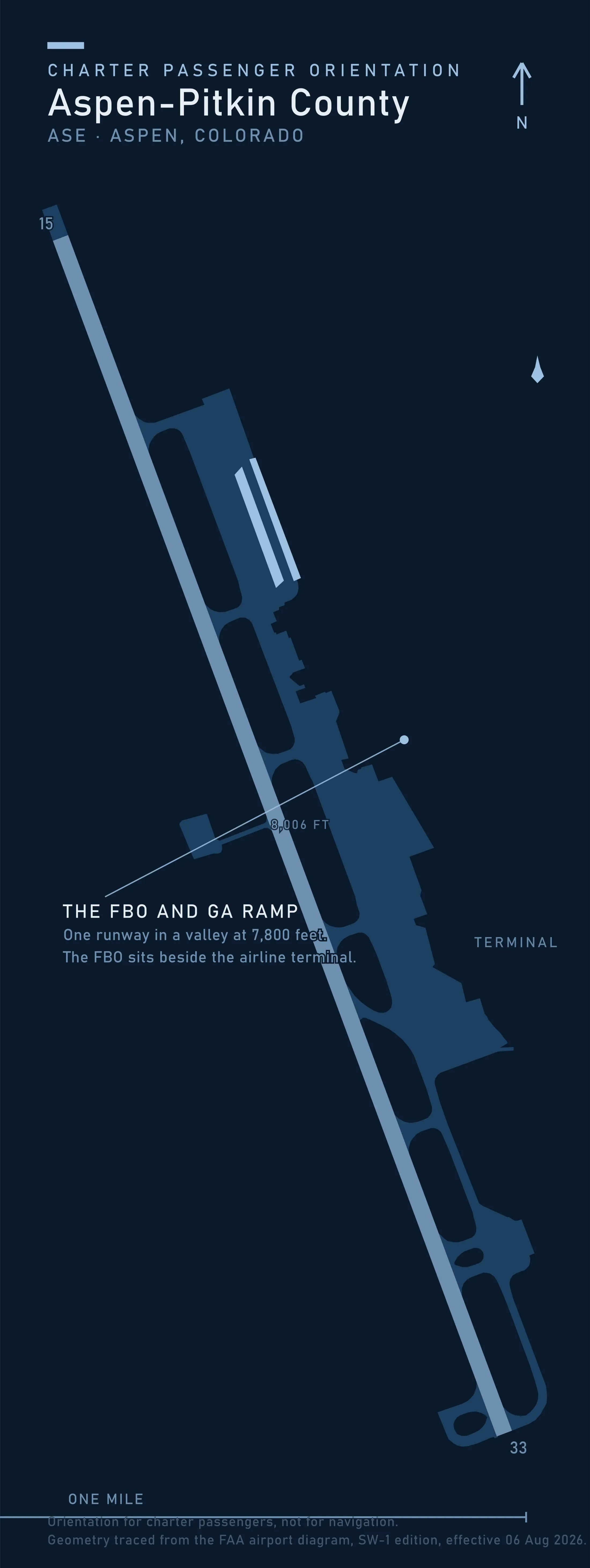
The mountain end. Two airports anchor the corridor’s high country: Aspen/Pitkin County Airport, serving Aspen and Snowmass, and Eagle County Regional Airport, serving the Vail Valley and Beaver Creek. Both handle significant winter traffic and are accustomed to charter operations, and both carry operating constraints that can include curfews, approach limitations, and weather minimums shaped by the terrain around them. Beyond the airports, resort-area helipads and private landing sites exist but are not uniformly available; whether a helicopter can land closer than the airport depends on the specific property, local rules, and the operator’s familiarity with the site. Where helicopters can and cannot legally set down is covered in Heliports & Landing Zones.
Typical Routes and Flight Times
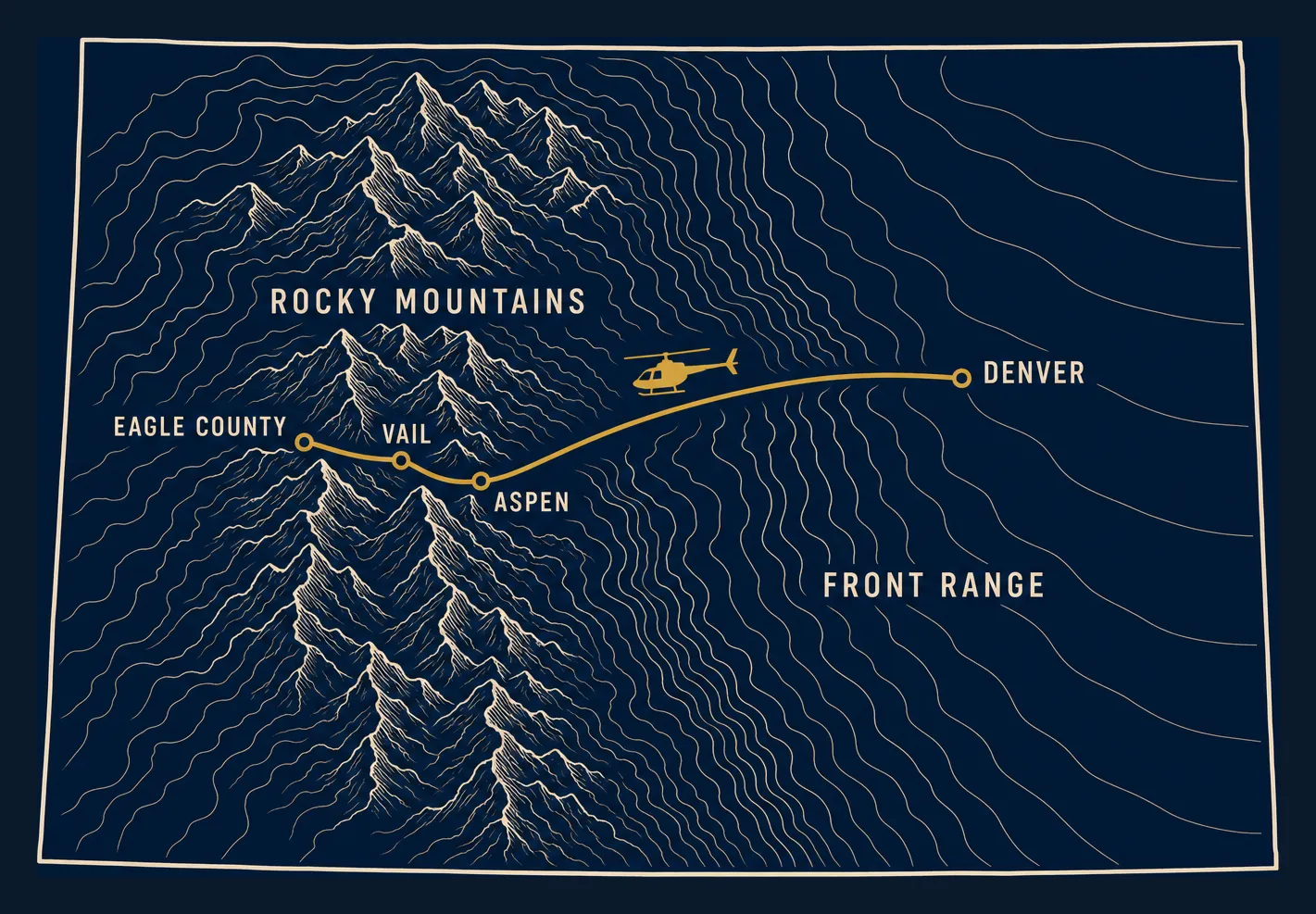
The two legs that define this market are Denver to Aspen and Denver to the Vail Valley via Eagle County. Both follow the same logic: a short flight that climbs from the plains over the high terrain and sets down in a mountain valley, replacing a drive measured in hours with a flight measured in a fraction of that time. The contrast is sharpest in winter, when the I-70 mountain drive can stretch far beyond its fair-weather duration behind snow, chain laws, and ski traffic, while the flight’s duration barely moves.
Predictable does not mean guaranteed. Mountain flying carries its own schedule risk, covered under Seasonal Patterns below, and the honest comparison is not “flight always beats drive” but “flight removes the drive’s worst-case variance while adding a weather dependency of its own.”
Seasonal Patterns
Winter is the peak. Ski season concentrates demand into weekends and holiday periods, and the same storms that bring the snow bring the market’s biggest scheduling risk. Mountain weather can change with little warning, and a helicopter that flew in easily on Thursday may face a genuine no-go on Sunday. Operators flying this corridor build margin into winter schedules, and travelers should too: the fallback is the drive, so keeping a ground option warm on storm days is standard practice rather than pessimism.
Summer is the second season. Festivals, weddings, and second-home traffic keep the corridor busy from late spring through fall, with a different weather signature: afternoon convective buildups over the high terrain that make morning departures more reliable than late-day ones. Summer also brings the density-altitude problem at its sharpest, covered next.
High-Altitude Operations
This is the one technical concept every corridor customer should understand. Density altitude describes how high elevation, worsened by heat, thins the air and reduces what a helicopter can do: engines produce less power, rotors produce less lift, and the aircraft’s ability to carry payload and fuel shrinks. The corridor’s mountain airports sit thousands of feet above the Front Range fields the flight departs from, and both are well above 6,000 feet, which means performance margins that are academic at sea level become real planning constraints here. In practice it shows up as a weight limit: on a hot afternoon at altitude, the operator may fly your party but not your party and all its luggage in one trip.
The practical consequences are that passenger counts, baggage, and fuel loads may be traded against each other, especially on hot summer afternoons, and that an operator may legitimately decline a load that would be routine at lower elevation. This is not an operator being difficult; it is the physics of mountain flying being respected. Deeper treatment of helicopter classes and performance belongs to the Helicopter Class Comparison Guide.
Which Charter Types Dominate Here
Resort transfers are the market’s core: the airport-to-resort and Denver-to-mountains legs that carry ski guests, second-home owners, and their gear. These are typically flown as part of broader resort and leisure charter arrangements; see Golf & Resort Charters for how resort-bound charter works as a charter type.
Leisure flying follows the calendar: sightseeing over the high country, special occasions, and weekend trips timed to festivals and events, always chartered as the whole aircraft rather than a per-seat ride.
Site visits run year-round and quietly underpin the market: energy, construction, real estate, and land projects in terrain where the road network is the bottleneck. See Site Visits & Facility Tours for that charter type.
Related Pages
- Destinations: the hub for all market pages.
- Aspen & the Maroon Bells: the upper end of this corridor, where the Elk Range and a pass that closes shape the flying.
- Vail Valley: the corridor market with an interstate through it, and the three places that interstate breaks.
- Telluride: the San Juan market in the state’s southwest corner, off this corridor and reached from Montrose.
- Denali: the other high-altitude mountain market, where thin air shapes the same decisions.
- Jackson Hole & the Teton Range: the Wyoming resort valley, where the airspace over the range is the constraint.
- White Mountains: the New England range where wind rather than thin air sets the limit.
- Golf & Resort Charters: the resort-transfer charter type that dominates this market.
- Site Visits & Facility Tours: the year-round utility side of mountain flying.
- Helicopter Class Comparison Guide: aircraft classes and the performance trade-offs that matter at elevation.
- Heliports & Landing Zones: where helicopters can actually land, in the mountains and elsewhere.
Heliports near Colorado Mountain Corridor
The FAA records 15 heliports within 50 miles of Colorado Mountain Corridor in the current cycle. Not one is public use, so every landing here starts with the owner’s permission. Your operator makes that arrangement before the flight is confirmed.
Heliports only. Airports are a separate class of facility and are not counted here, and in many markets the charter itself works from one.