
Charter market
JacksonHole&theTetonRange
A Range With No Foothills
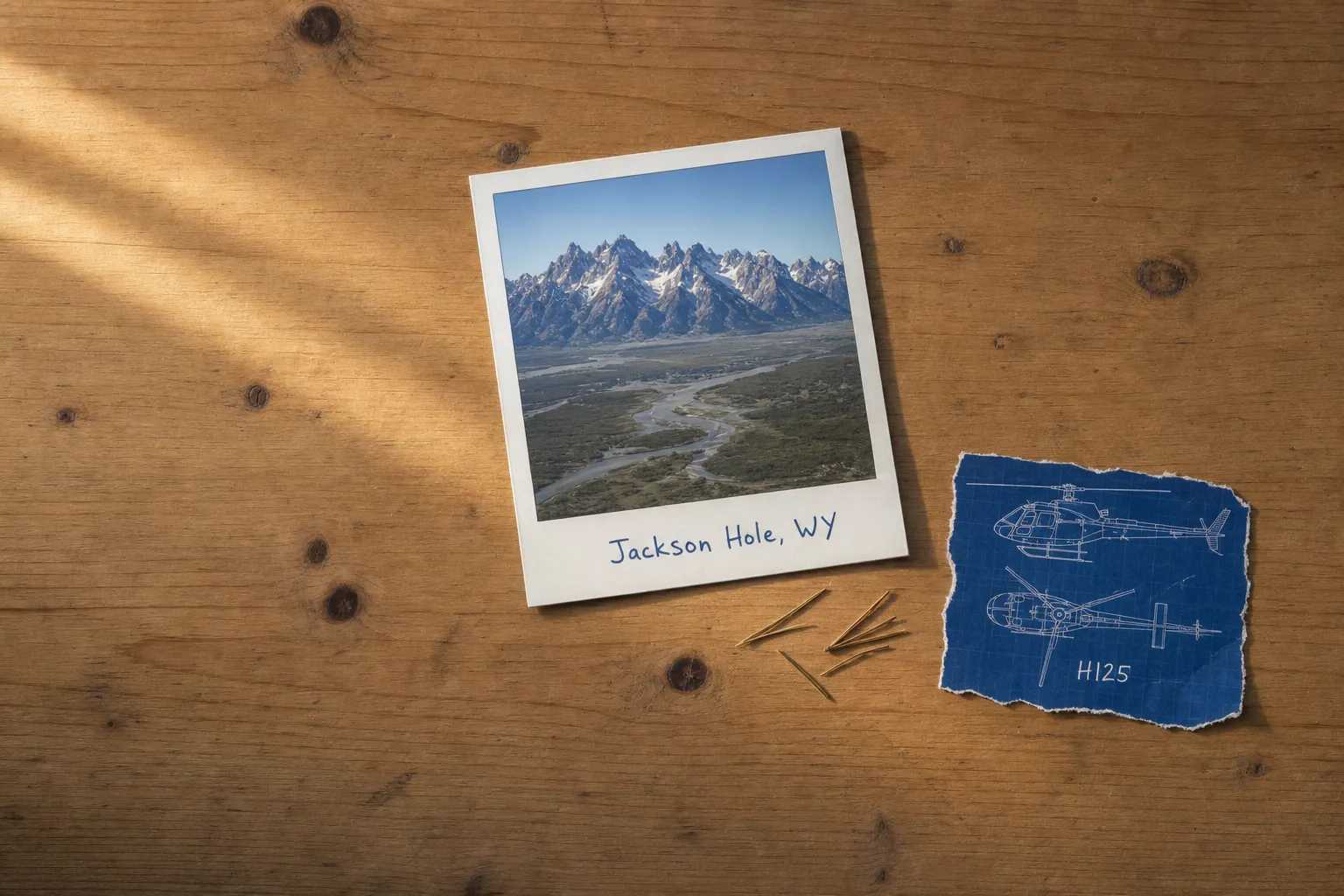
Most mountains announce themselves gradually. The Tetons do not. A fault runs along the eastern base of the range, the valley floor dropped, the rock rose, and what stands there now is a wall of granite off flat ground with nothing in between. The Park Service puts the Grand Teton at 13,770 feet, its summit formed of 2.7-billion-year-old gneiss and 2.5-billion-year-old granite, and the valley below sits at roughly half that. Seven thousand feet of relief with no approach to it is why this range turns up on so many calendars.
A hole, in trapper usage, is a flat basin ringed by mountains, and this one carries the name of David Jackson. On its floor: the Snake River in braided channels, Jackson Lake and Jenny Lake against the base of the range, sagebrush flats holding one of the largest elk winter concentrations in North America, one small town. Around it on three sides, the Bridger-Teton National Forest and its 3.4 million acres.
What a Flight Actually Reaches
The Teton front from the valley side. The whole range as one wall, its canyon mouths, moraine lakes and fault line legible as a single geological argument rather than separate viewpoints.
The Gros Ventre Range. The valley’s eastern wall, far less visited, holding the scar of the 1925 landslide that dammed the Gros Ventre River and the lake behind it.
The Wind River Range. Southeast beyond the Gros Ventre, holding Wyoming’s highest summits and glaciers that survive only because the range is tall enough to keep them.
The Snake River Range and the Palisades. Southwest along the Idaho line, where the river turns into a canyon and the country becomes the deep snow the valley’s winter flying works in.
The valley floor. Braided channels, elk on the winter range, ranch country in a bowl.
The Range Is the View, Not the Racetrack
Almost all of the Teton front is inside Grand Teton National Park, and sightseeing circuits over a national park are a regulated category rather than an ordinary charter leg. The Park Service defines a commercial air tour as a flight for compensation whose purpose is sightseeing over a park, below 5,000 feet above ground level and less than a mile laterally from any park feature, or within half a mile outside the boundary. Where enough of them fly, the FAA and the Park Service agree a plan fixing routes, altitudes and numbers; parks running fifty or fewer a year are exempt. What flies over the Tetons is contested from the valley floor, and routing here reflects that.
So a flight here keeps the range in the window rather than orbiting it, and still gives you the whole wall, because a range this abrupt reads better from a few miles out than from overhead. If your trip is specifically an aerial tour of the Grand, this is the wrong valley for it. How charter-framed scenic flying works elsewhere is in Scenic & Sightseeing Charters, under the rules in FAR Part 135 for Charter Customers in Plain-English.
Roadless Is Not the Same as Landable
The reason to want a helicopter in western Wyoming is that most of it has no road. But a large share of that roadless country is designated Wilderness, nearly 1.2 million acres inside the Bridger-Teton alone, and the Wilderness Act prohibits the landing of aircraft there, with narrow allowances where a use was established before designation. That is federal statute rather than local preference, and it means the map carries two kinds of blank space, one you may put down in and one you may not.
What is left is still a great deal: forest outside the Wilderness boundaries, private ranch ground, state land, and the developed sites around the valley, all needing the landowner or the managing agency to agree first. That is the subject of Heliports & Landing Zones.
Where Flights Operate From
The Park Service notes that Jackson Hole Airport is the only commercial airport within a national park in the country, the field having predated the park’s expansion around it, and it works under a use agreement and lease with Grand Teton rather than its own authority alone.
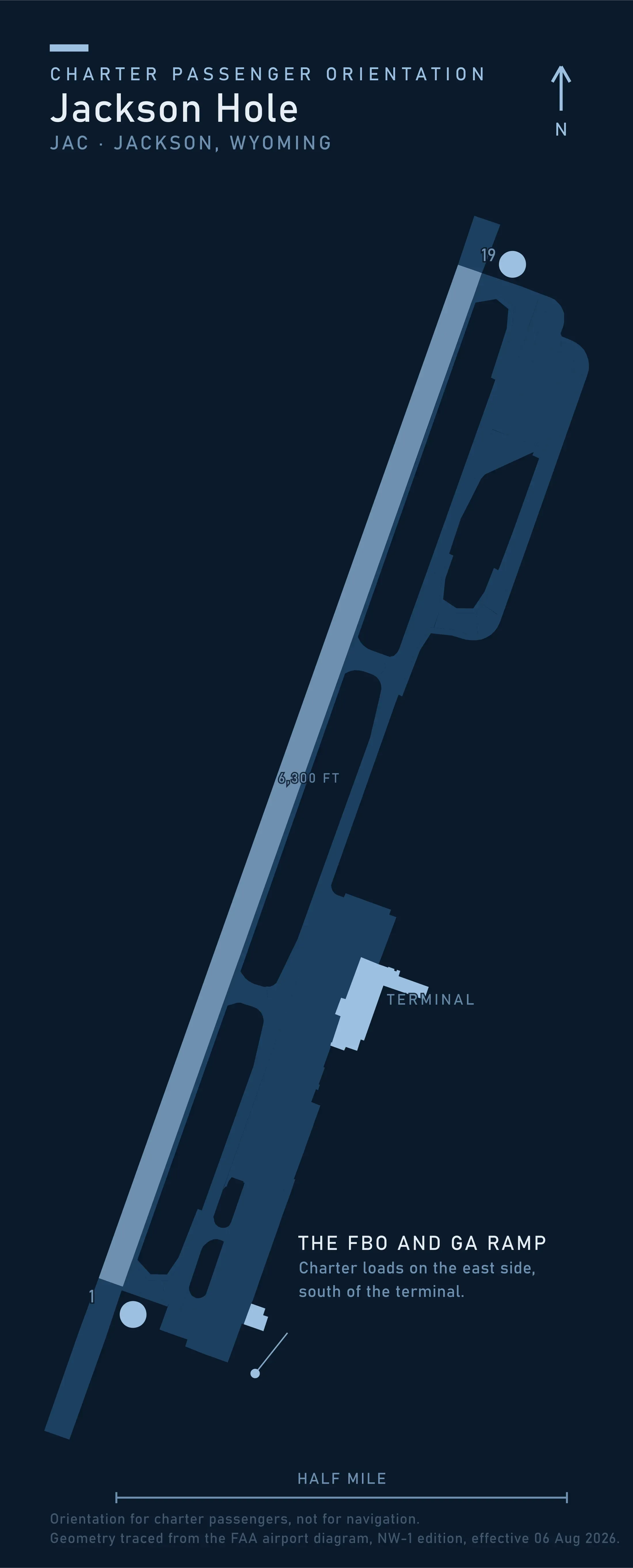
The FAA airport diagram gives one runway, 1-19, at 6,300 by 150 feet, on a field 6,451 feet above sea level, with the terminal, hangars and general aviation ramp all on the east side. The airport asks that aircraft neither land nor take off between 9:30 in the evening and 7 in the morning and says plainly that the measure is voluntary and unenforceable by it. Treat it as real anyway: it is the reason the valley tolerates the traffic, and a late departure is a favor rather than a right. What exists elsewhere in the state, from hospital pads to ranch strips, is mapped on the Wyoming page of the Heliport Atlas.
Typical Routes and Flight Times
The valley arrival. Airport to a lodge, a ranch or Teton Village, the most common leg here and the one that turns a road transfer over a pass into a few minutes, in the pattern set out in Airport Transfers.
The pass hop. Over the Tetons or the Snake River Range to Idaho, Star Valley or Pinedale, where road distance and air distance stop resembling one another.
The backcountry drop. Into forest or private ground for fishing, hunting, survey or camp support, planned around where a landing is permitted.
The Wind River leg. Southeast to the high country, where a flight bought for scenery goes when it will not go west.
What Hiring the Whole Aircraft Changes
You get the hour the mountains work in. A range this steep is lit for about an hour after sunrise and an hour before sunset, and reads flat and grey between. A shared departure flies when the seats fill, which is rarely then, and the difference is the subject of Aerial Photography & Film.
You choose the country. The obvious circuit is not the product here, so the value is in picking another: the Gros Ventre, the Winds, the river canyon, or none of them if the day is wrong.
You carry what the trip needs. Rods, rifles, camera bodies, survey gear and camp weight come out of one allowance, and it is smaller here than it looks, for reasons in Helicopter Class Comparison.
You buy the aircraft’s time rather than a seat, which is the whole of the difference in What a Charter Costs.
What Stops a Flight Here
Altitude is the first limit, and it is arithmetic rather than weather. The field is already at 6,451 feet, the summits stand at more than twice that, and on a hot afternoon the air behaves as though it were thousands of feet higher still. Engines and rotors both lose performance in thin air, so the load an aircraft lifts on a cool morning is not the load it lifts that afternoon. High-altitude work in the Rockies runs on light singles built for it, and the payload question is worth asking early.
Wind is the second. Prevailing westerlies crossing a wall of rock make rotor, turbulence and downdraft on the lee side routine, and summer afternoons add build-ups over the high ground. Mornings are the flyable part of a mountain day, and what a marginal forecast does to a booking is in Weather, Delays & Scheduling.
Seasonal Patterns
Summer is the long season, with the best light early and late and the steadiest air before noon. Autumn is the quiet one and arguably the best: cold clear air, aspen gold against dark conifer, elk moving down. Winter is deep snow and short days, when the valley fills with skiers and the flying moves toward transfers and toward the terrain south and west where Heliskiing operates under Forest Service permit. Late spring is the awkward gap: runoff, closed roads, empty streets.
Which Charter Types Dominate Here
Transfers, more than anything: airport to lodge, valley to valley, over passes that close.
Backcountry access and support, onto permitted ground, for fishing, hunting, ranch work and survey.
Photography and film, drawn by a range easy to point a camera at and hard to photograph well.
Scenic flying, genuine but shaped by the airspace above, and better sold as the country east and south of the Tetons.
Related Pages
- Destinations: the other US charter markets.
- Yellowstone: the plateau north of here, where the distances between gateways are the argument.
- Colorado Mountain Corridor: the other high-altitude resort market, where the transfer case is the business.
- Aspen & the Maroon Bells: the Colorado valley under the same landing rule.
- Denali: a taller range where the limit is the mountain’s own weather, not the airspace over it.
- Black Hills & Mount Rushmore: the range east of here where the airspace over the monument is the limit.
- Heliskiing: how winter access flying is permitted, planned and priced.
- Heliports & Landing Zones: who has to agree before an aircraft touches down.
- What a Charter Costs: what you pay for when you hire the aircraft rather than a seat.
Heliports near Jackson Hole & the Teton Range
The FAA records 6 heliports within 50 miles of Jackson Hole & the Teton Range in the current cycle. Not one is public use, so every landing here starts with the owner’s permission. Your operator makes that arrangement before the flight is confirmed.
Heliports only. Airports are a separate class of facility and are not counted here, and in many markets the charter itself works from one.