
Charter market
NapaValley&SonomaCoast
Two Landscapes, and the Gap That Explains Both
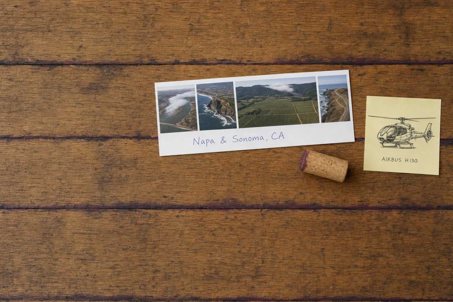
Napa Valley runs about thirty miles from the city of Napa up to Calistoga, never more than a few miles wide, walled by the Mayacamas Mountains on the west and the Vaca Range on the east, with a peak a little over four thousand feet at its head. Thirty miles west of that wall the land stops: the Sonoma Coast is bare grass bluff, dark rock and open Pacific, with the Russian River cutting through the last ridge to reach it.
Between them runs a break in the Coast Range. South of Santa Rosa the hills that hold the ocean out thin and drop away, and cold marine air pours through the low country around Petaluma and runs southeast to San Pablo Bay. The Petaluma Gap is why the western side of this market is cold and windy while the valley floor inland bakes, and why a coastal morning can be solid grey with Calistoga in full sun.
That is the flight. On the ground you are inside the weather and cannot see its shape. At two thousand feet the fog is an object: a white river with a leading edge, pushing through a notch in a ridge line and thinning as it goes. Ocean, gap, valley and sun in one frame.
What a Flight Actually Reaches
The valley floor as a plan. Highway 29 up one side, the Silverado Trail up the other, and between them a grid of blocks in a dozen greens. It reads as a drawing, which it never does from a car.
The Mayacamas crossing. Napa side to Sonoma Valley is a few minutes over a forested ridge, against a grade of switchbacks and the better part of half an hour by road.
The Russian River, end to end. Out of Alexander Valley, through Healdsburg, into a canyon of second-growth redwood past Guerneville, and out at Jenner, where a sandbar builds across the mouth and breaks with the winter flow.
Seventeen miles of coast under one wing. Sonoma Coast State Park spans 17 miles from Bodega Head to Vista Trail, a craggy coastline with natural arches and secluded coves. On the ground it is a dozen pull-offs on Highway 1. In the air it is one continuous edge.
A Russian fort on a marine terrace. North up the coast from Jenner, Fort Ross State Historic Park preserves several buildings and a reconstructed stockades wall of North America’s southernmost Russian colony, founded in 1812, a square on an open bench above the surf.
The fault, drawn straight. The San Andreas comes ashore under Tomales Bay and leaves the land again at Bodega Head. From altitude the bay is not a bay shape at all but a ruled line, and the coast then makes a different kind of sense.
The Vineyards Are the Least of It
Vineyard rows photograph beautifully from close range and become texture at two thousand. The valley floor is flat, orderly and crossed in three minutes, and a flight sold on the vineyards alone will feel short. What earns the altitude is everything around them: the ridge wall, the river canyon, the fog in the gap, the coast.
The Field in the Valley, and the One Across the Ridge
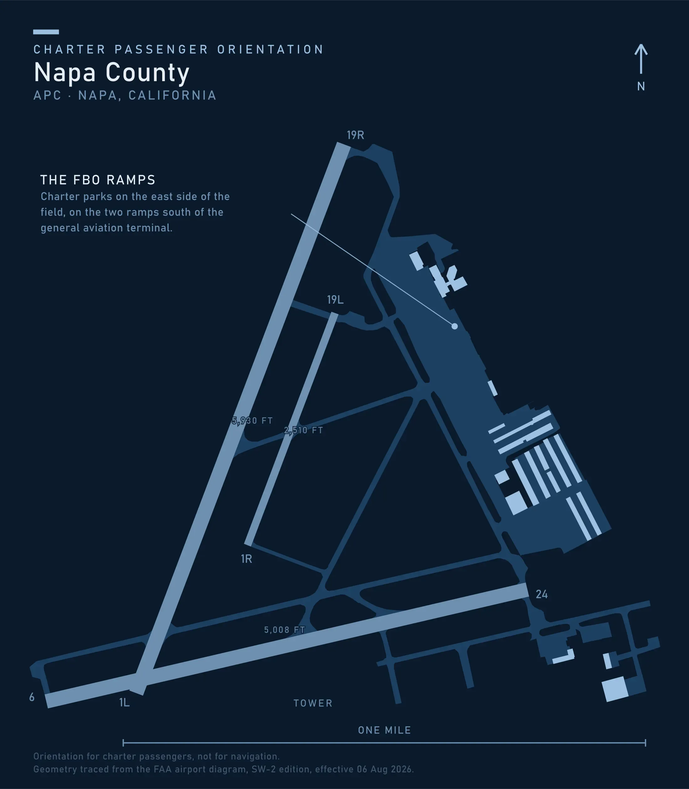
Napa County Airport is open to the public, carries runway 01L/19R at 5,930 by 150 feet, has a control tower operational 0700 to 2000, an ILS on runway 01L, and no heliport on its record, and charges a landing fee to all air taxi and commercial aircraft operations. The instrument approach matters more here than the runway length: what closes this field is not wind but the same marine layer that made the wine.
Across the Mayacamas, Charles M. Schulz Sonoma County Airport carries runway 14/32 at 6,000 by 150 feet, has a tower operational 0700 to 2000, and likewise has no heliport on its record. It is much the closer field to the coast, ten minutes to the Russian River mouth against twenty-odd from Napa. That both towers keep fixed hours matters when the plan involves an evening return.
Eight Registered Pads, and Not One of Them Public
The California page of the Heliport Atlas maps what the FAA record holds: four registered heliports in Napa County, four in Sonoma County, and not one of the eight open to the public. Three hospitals, a medical centre, a county fire department, a motor circuit, a farm, and one private site.
There is no arriving at a tasting room by air as an ordinary matter, because the pads to do it with do not exist. Every landing away from an airport is a permission negotiated with whoever owns the ground, which makes who controls the site the first question of the planning and puts most of the work back on the two airports.
When the Drive Wins, Which Is Often
Two roads run the length of the valley, everything worth stopping at is on one of them, and the drive from San Francisco is straightforward outside commute hours. For three days in one valley a car is the right tool, not a compromise.
The marine layer is the second concession. The air that comes through the gap sits on the coast into the late morning for much of the summer, so a coastal leg planned for nine is often flown at eleven.
What a flight earns is narrower: the valley and the coast in one day, an arrival from a long way off, and a schedule that does not survive four hours in a car each way.
Typical Routes and Flight Times
The San Francisco Bay leg. About twenty minutes from the bay’s airports, against a drive that swings by an hour with the bridges. Ordinary airport transfer work.
The coast crossing. Napa to the mouth of the Russian River in twenty-odd minutes, or ten from Santa Rosa, against the better part of two hours by road. It is why the two halves of this market rarely meet in one day.
The valley and coast circuit. The Mayacamas, the river canyon, the coast and back over the gap, flown as whole-aircraft scenic and sightseeing charter.
The Sierra leg. About an hour east across the Central Valley to Lake Tahoe, which is how a wine-country weekend becomes a mountain one.
What Hiring the Whole Aircraft Changes
You can wait for the fog, or go the other way. Holding the aircraft turns a grey coast at ten into an inland route at ten and a coastal route at noon. A shared per-seat flight runs a fixed circuit on a fixed clock and takes whatever the marine layer gives it.
Both counties fit in one afternoon. Valley, ridge, river and coast is two days of driving and one arc in the air.
You choose which side you sit on. Over a coast running north to south, that decides the whole job for aerial photography and film.
A landing you arranged stays yours. Ground access here is a permission granted to a party rather than a seat sold on a schedule, which is the substance of what a charter costs.
Seasonal Patterns
Summer is grey mornings and clear afternoons. The marine layer is deepest from June into August. Expect the coast in cloud early and the valley in sun by mid-morning, and build the day around that.
Harvest gives the best flying of the year. From late August into October the marine layer thins, visibility inland runs long, and the valley floor turns colour.
Winter is rain, low cloud and green hills. Atmospheric rivers come ashore in earnest. Ceiling and visibility rather than cold move a departure.
Spring is the windy season. The gap is at its most reliable in the spring afternoons, which the aircraft plans around.
Which Charter Types Dominate Here
Transfers from San Francisco and the bay’s airports, the shortest leg and the most repeated.
Whole-aircraft scenic flying, sold honestly as the ridges, the river and the coast.
Restaurant and winery days, the ordinary shape of winery and restaurant flying, always an airport arrival with a car at the far end.
Property and land work. Real estate and land inspection across hillside parcels a road does not reach, and aerial survey of vineyard and rangeland.
Related Pages
- Destinations: the other US charter markets.
- Big Sur Coastline: the same ocean, where the range leaves no room for a road.
- Lake Tahoe: an hour east, and the weekend’s usual second half.
- San Francisco Bay: twenty minutes south, and where the day usually starts.
- Channel Islands: the California coast with nowhere at all to land.
- Southern California: the state’s other end, and its busiest airspace.
- Scenic & Sightseeing: how a whole-aircraft route gets planned.
- Winery & Restaurant: the ground half of the day.
- Weather, Delays & Scheduling: what a marine layer does to a departure.
- Heliports & Landing Zones: the permission a private site needs.
Heliports near Napa Valley & Sonoma Coast
The FAA records 23 heliports within 50 miles of Napa Valley & Sonoma Coast in the current cycle. Not one is public use, so every landing here starts with the owner’s permission. Your operator makes that arrangement before the flight is confirmed.
Heliports only. Airports are a separate class of facility and are not counted here, and in many markets the charter itself works from one.