
Charter market
SanFranciscoBay
One Bay, and Everything Famous Sits on the Edge of It
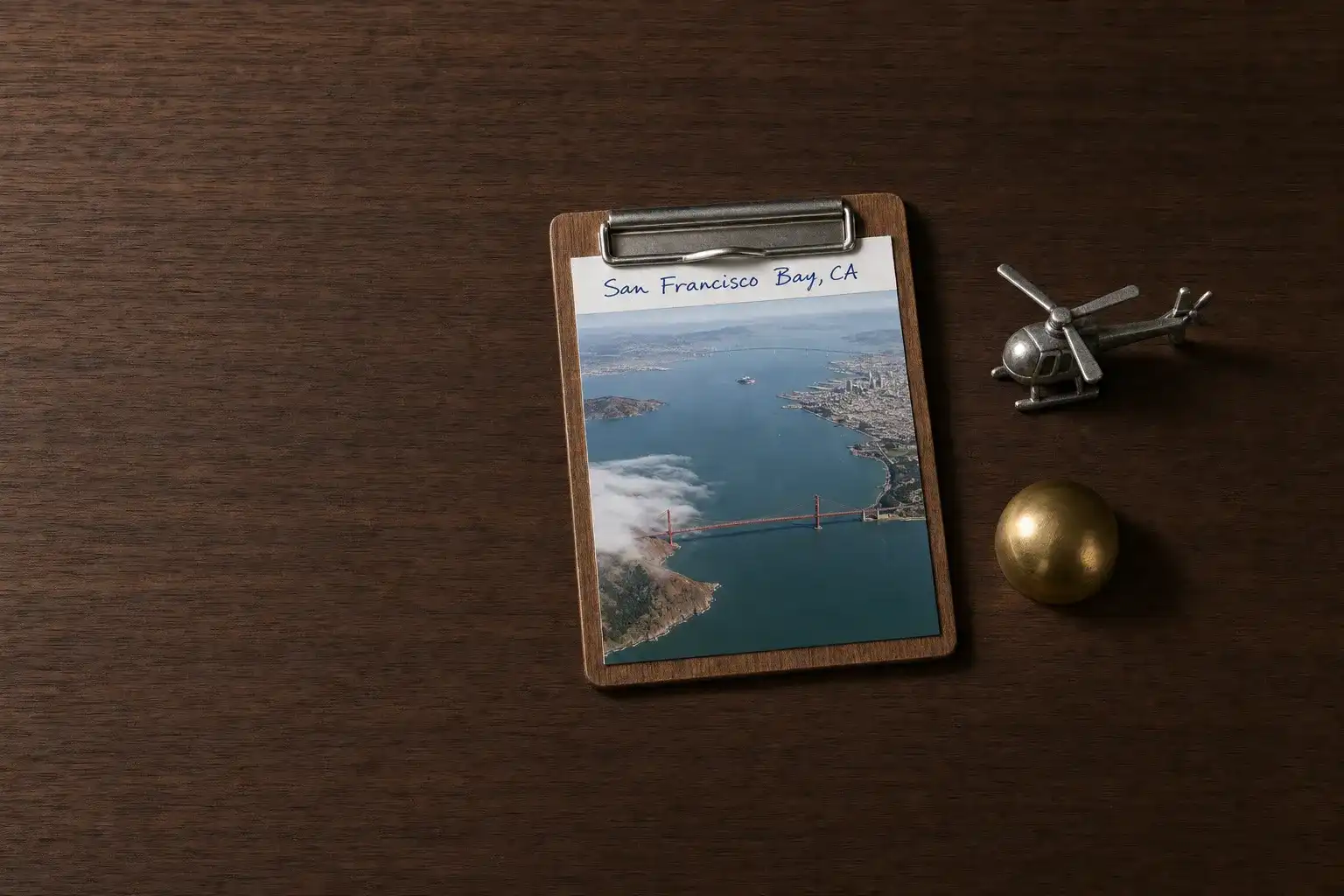
San Francisco Bay is a drowned river valley with a single narrow outlet. Sixty miles of water run from the marshes at Alviso up to San Pablo Bay, and all of it drains through a strait about a mile wide with a mountain wall on either side. The city holds the tip of a peninsula, Marin rises across the water, and the East Bay hills close the far side.
Every landmark this market is known for is an edge of that basin: the strait and the bridge over it, the five crossings of the bay proper, the islands in the middle, the headlands, the tidal flats at the south end. On the ground you stand at exactly one of those edges at a time, and each one hides the next.
That is the flight. At two thousand feet the edges stop being separate places and become one object: a bowl of water with a gap in its western wall, a city on a thumb of land, and on most summer mornings a white river of fog coming through the gap.
What a Flight Actually Reaches
The strait, from above and from both sides. The bridge is photographed from a dozen viewpoints on the ground, all of them at sea level and most looking at the same face of it. From the air it is a line drawn across a gap in a ridge, open ocean on one side and sixty miles of bay on the other.
Alcatraz, which you cannot land on. The National Park Service is plain about it: the only way to get to Alcatraz is by a ferry. An aircraft changes nothing about that. What it does is put the island in context, a rock a mile or so offshore in a working harbour, which is the one thing the ferry queue never shows you.
The bridges as a set. Five crossings span the bay, from the orange one at the mouth to the flat causeways at the south end, and in a single arc they read as the same problem solved five times at different widths.
The salt ponds at the south end. The South Bay Salt Pond Restoration Project is a 50-year effort to restore 15,000 acres of tidal marshland on ground worked as salt evaporation ponds since the mid-19th century. The ponds are geometric, enormous and vividly coloured, and from a levee they are a flat brown horizon. Nothing else in the market is so completely a landscape of altitude.
The fog with a shape. From the city the marine layer is weather that happens to you. From above it is an object with a leading edge, thick over one district and absent over the next.
Eighteen Registered Pads Around the Water, and Not One of Them Public
The California page of the Heliport Atlas maps what the FAA record holds for the five counties that ring the bay: eighteen registered heliports, and not one open to the public. Seven are hospital pads, three more sit at medical centres the record files as private, three belong to government and public-safety agencies, two are military, one serves utility infrastructure, and two are private sites.
Four of the eighteen are inside San Francisco itself: two public-safety pads and two at medical centres. There is no commercial landing site in the city, and there has not been one for decades.
Read plainly, that is the market. A helicopter does not deliver anyone to a hotel door here: it lands at an airport on the rim of the bay and a car covers the rest, which makes who controls the ground the first planning question rather than the last.
The Fields on the Rim
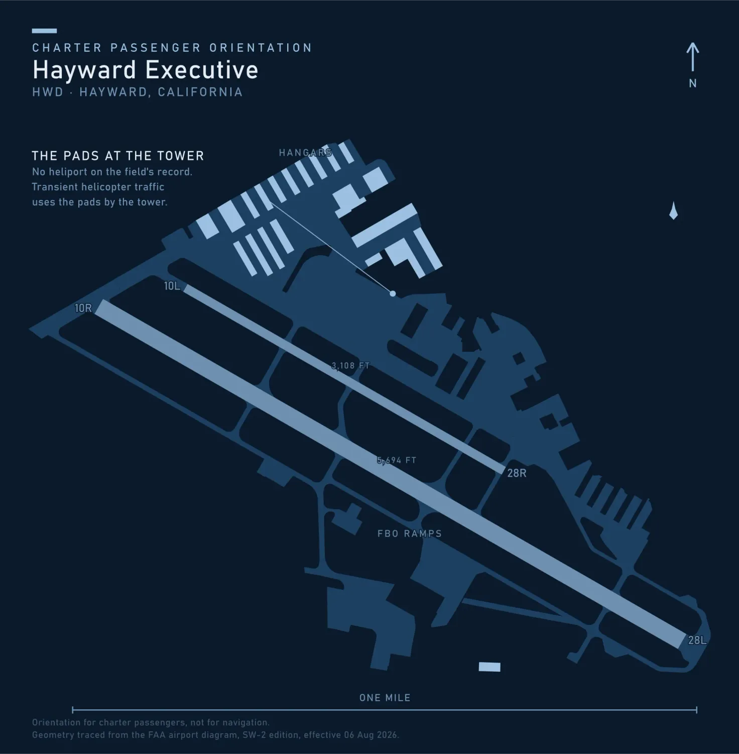
Hayward Executive is open to the public, carries runway 10R/28L at 5,694 by 150 feet and 10L/28R at 3,108 by 75, has a tower operational 0700 to 2100, charges no landing fee, and lists no heliport. The same record then adds the line that matters: transient helicopter traffic uses helipads west of the green ramp, located at the base of the tower. No heliport on the books, pads in practice, and a tower that closes at nine.
Across the water, Oakland San Francisco Bay Airport is open to the public with four runways, the longest 10,520 by 150 feet, a tower operational 24 hours, and a landing fee in effect 24 hours a day. It is the closest field of any size to the city, and the one that takes an arrival at midnight. County fields down the peninsula and up in Marin fill in the ring.
Three air-carrier airports share this basin, and their arrival and departure paths cross most of the water worth looking at. That does not stop a charter flying, but it decides the route: a helicopter here works around the airline traffic rather than through it, and the answer to “can we go straight there” is sometimes no.
When the Bridge and the Ferry Win
The Golden Gate is one of the good drives, the ferry to Sausalito takes half an hour and lands you at a restaurant, and San Francisco itself is seven miles square. Inside that square a helicopter saves nobody time, because there is nowhere in it to land.
What the aircraft is for is the ring outside. Napa and the Sonoma Coast are twenty minutes north. Monterey and the top of the Big Sur coast are about forty-five minutes south. Lake Tahoe is about an hour east over the Central Valley and the Sierra crest. Each is a half-day drive with traffic in it, and an ordinary weekend leg by air.
Typical Routes and Flight Times
The bay circuit. Ten minutes from an East Bay or peninsula field to the strait, then the islands, the bridges and the waterfront, as whole-aircraft scenic and sightseeing charter. Half an hour covers it, an hour does it properly.
The wine country leg. Twenty minutes to the Napa or Sonoma fields against ninety minutes of bridge and freeway.
The Sierra leg. About an hour to Lake Tahoe, which is the trip that most often justifies the aircraft outright.
What Hiring the Whole Aircraft Changes
You can wait out the fog, or fly the other half first. Holding the aircraft turns a socked-in morning at the Gate into an inland route at ten and a coastal one at noon. A shared per-seat flight runs a fixed circuit on a fixed clock and takes what the marine layer gives it.
You choose which side you sit on. Over a strait crossed by a single bridge, that decision is the whole job for aerial photography and film, and it cannot be made from a seat number.
A landing you arranged stays yours. Every non-airport landing here is a permission granted to a party rather than a seat sold on a schedule, which is the substance of what a charter costs.
Seasonal Patterns
Summer mornings are grey, and they do not clear evenly. The National Weather Service puts it precisely: the mornings will typically find the entire city overcast followed by clearing on the warmer bay side, but only partial clearing on the cooler ocean side. Ten miles decides whether a departure happens, so build the day so the ocean side comes second.
Spring and autumn are the flying seasons. These seasons usually produce the most cloud-free days between the overcast days of summertime stratus and the rain laden clouds of winter. September and October are the clearest and warmest weeks of the year here, the reverse of what most visitors plan around.
Winter is rain and low cloud in fronts, with clear air between them. Ceiling and visibility rather than cold move a departure, and the day after a front is often the sharpest air of the year.
Which Charter Types Dominate Here
Airport and field transfers, the most repeated job here, and the one where the aircraft beats the car outright.
Corporate and executive movement across a working geography spread over five counties and cut in half by water.
Whole-aircraft scenic flying, sold honestly as the bay and the strait rather than as a flight over the city.
Camera work. The bridges, the waterfront and the salt ponds keep aerial photography and film crews busy, and real estate and land inspection follows the same shoreline.
Related Pages
Heliports near San Francisco Bay
The FAA records 28 heliports within 50 miles of San Francisco Bay in the current cycle. Not one is public use, so every landing here starts with the owner’s permission. Your operator makes that arrangement before the flight is confirmed.
Heliports only. Airports are a separate class of facility and are not counted here, and in many markets the charter itself works from one.